- DE
- EN
Studies of wind potential
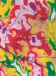
Cartographic representation of wind resource (Detail)
In line with the surveys of wind potential the wind resource is determined and presented for a big area by measurements and model calculation. Especially cartographic representations of the potential yield offer in its results – cut in a GIS with further information – a solid base for further decisions. The engineering office Kuntzsch was able to gain extensive experiences on this topic, amongst others by compiling the following surveys:
The use of wind energy in the Free State of Saxony, wind measuring programme 1992 – 1994
Survey of the wind potential in Brandenburg 1992 – 1993
Survey of the use of wind energy at spoile piles in the Lausitz 1993 – 1995
Survey of the wind potential for the south-west of Portugal 2000 by order of BOREAS Portugal – Energia Eolica Lda.
Survey of the wind potential for the energy gardens in the Lausitz 2001
Survey of the wind potential Thüringer Becken 2003 by order of Thüringenwind GmbH
The scope of services of our surveys can vary highly depending on the aim and the existing information pool; amongst others it may include:
The inquiry of available wind measuring data and yield data of existing wind energy plants in the investigation area,
The procuring of the necessary topographic maps and satellite pictures,
On-site-examination of map data
Digitizing of the orographical and roughness data to build up a digital terrain model,
Grid-shaped model calculation of the parameters of the wind flow
Cartographic representation of the results and the preconditions for the calculations